Washington State Professor Finds Sky-high Opportunities for Drones in Agriculture
Erin Anthony
Director, Communications

photo credit: AFBF Photo, Philip Gerlach
Erin Anthony
Director, Communications
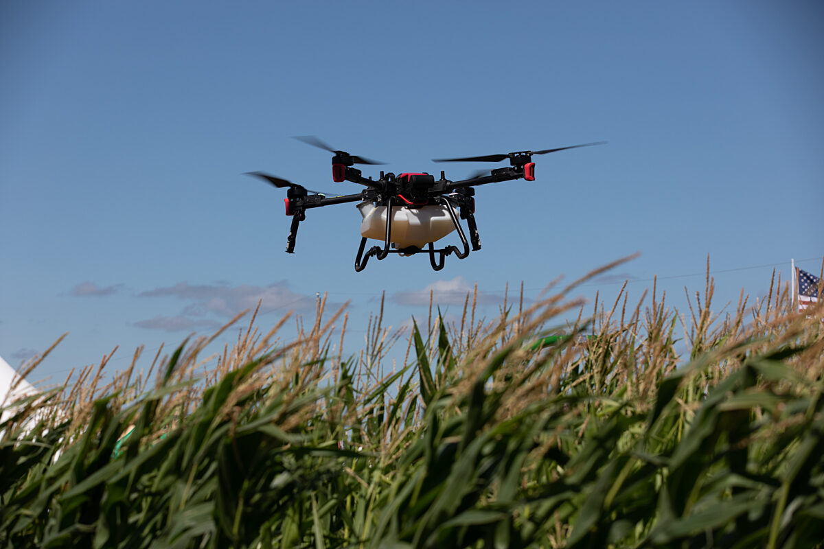
Many farmers and ranchers are already benefitting from drone technology, but the work of researchers like Dr. Lav Khot is showing that we’ve only scratched the surface of what this relatively new technology can do for agriculture. Khot works for Washington State University’s Center for Precision and Automated Agricultural Systems and in the agricultural automation engineering research emphasis area of the Department of Biological Systems Engineering.
Khot is involved with several projects that delve into how drones can help with many aspects of Washington’s diverse agriculture industry—from grapes, apples and cherries to winter wheat, potatoes, pinto beans and more.
One of the most prominent ways in which drones are used in agriculture is for thermal imaging. Multi-spectral sensors mounted on a drone can give users like Khot a good picture of how crops, specifically crop canopies, fare under different growing practices.
Two of the projects in which Khot is involved look at how crops react to different irrigation techniques.
Teaming up with his colleague Dr. R. Troy Peters, irrigation engineer and Extension specialist, Khot is evaluating which of two irrigation techniques—mid-elevation irrigation or low-elevation irrigation—is more suitable for a chosen site. With the low-elevation irrigation, the sprinklers are positioned close to the canopy so there are very few evaporation losses. According to Khot, drone-gathered multi-spectral and thermal imaging data is a good indicator of crop vigor and canopy stress as the team evaluates this cost-effective practice in potato and mint production.
Another irrigation-related project uses drones to see how wine grapes respond to subsurface irrigation, in which water is applied at various levels to the root of the plant-30 centimeters down, 60 centimeters down and 90 centimeters down.
“We are, again, using drone technology to look at the stress that might be there in the canopy.”
Prof. Lav Khot
In addition, Khot is looking at how drone imaging can help winter wheat farmers decide whether to forge ahead or reseed their fields after an earlier-than-expected cold snap. Such a cold snap could cause a hard layer to form on the winter wheat seed, preventing plant emergence. Drone imaging can give winter wheat farmers a better view of where and how many of their winter wheat plants may be sprouting toward the end of the winter season, when the weather warms up.
“Then they can decide if they want to continue, or maybe plant some spring wheat instead,” Khot said.
While there’s an emphasis on the here and now in the drone industry—using drone imaging to help farmers make real-time decisions—Khot and other researchers are also using data gathered from drone cameras to see how certain crops, like potatoes and pinto beans, will respond to the climate of the future—one in which there will likely be less water for irrigation and warmer summer temperatures.
For the pinto beans, Khot and USDA-Agricultural Research Service researcher Dr. Rick Boydston and his team are “reducing the irrigation level from the normal 100 percent to 50 percent to see which ones will survive the stress and which will not, and which will do better. We’re also looking at how tillage and no-tillage affect the pinto beans with the different levels of irrigation.”
In addition, Khot is looking at drones as a more efficient and cost-effective way to shake excess water off the canopies of sweet cherry trees after a seasonal summer rain. Fresh-market sweet cherries are a premium crop in Washington. When heavy rains come through, as they often do in June and July, the maturing fruit can split or crack. So growers will rent a helicopter—for about $20,000—to fly over the trees and shake the canopies.
As Khot explained, in addition to the cost of renting a helicopter and paying a pilot, there’s an addition concern: Washington cherry orchards are not on flat ground, making it especially precarious for the helicopters and their pilots.
“We thought, why not try this mid-sized unmanned helicopter from Yamaha to see how efficient it is to remove the water from the canopies. We have found a good combination of flight altitude and travel speed to remove the water.”
One drawback is the size of the unmanned helicopter compared to a piloted-helicopter.
“Of course, the scale is not there. The big helicopter is about 30 feet in diameter and [the unmanned helicopter] is about 10-and-a-half feet. So you are looking at one-third of the coverage.”
Still, Khot said it’s very promising for small orchards or hard-to-reach spots in larger orchards.
Drone World Expo
Agriculture-related drone research and much more will be discussed at the Drone World Expo, a two-day conference that focuses on the latest advancements in the commercial drone industry.
Through its partnership with the DWE, Farm Bureau is offering members free registration for the event, which will take place October 3-4, 2017, at the San Jose Convention Center.
The conference will feature sessions and case studies addressing the ever-evolving regulatory environment for commercial drone use, as well as the most up-to-date and critical information for professionals using drone technology for agriculture, mapping and surveying, utilities, oil and gas, conservation initiatives, real estate and much more.
Farm Bureau members who are end-users of drone technology qualify for a complimentary full conference pass. Non-end-users will receive free expo passes, which include admission to exhibits, keynotes, Tech Talks, demos and receptions. For more information, go to www.droneworldexpo.com/fbn.